The Environmental Hazards and Meteorological Disasters Research Group was established in 1995, at the Centre for Natural Disaster Mitigation Studies of Iran. Its foundation was suggested by the Housing Foundation of Islamic Revolution and approved by the Board of Trustees. Since 2004, following the approval of the statute of the Natural Disasters Research Institute by the Ministry of Science, Research and Technology, this Research Group has been operating.
The research group conducts research on natural hazards such as earthquake, landslide, flood, etc. It also undertakes geotechnical studies on suitable solutions for prevention and mitigation of natural hazard impacts.
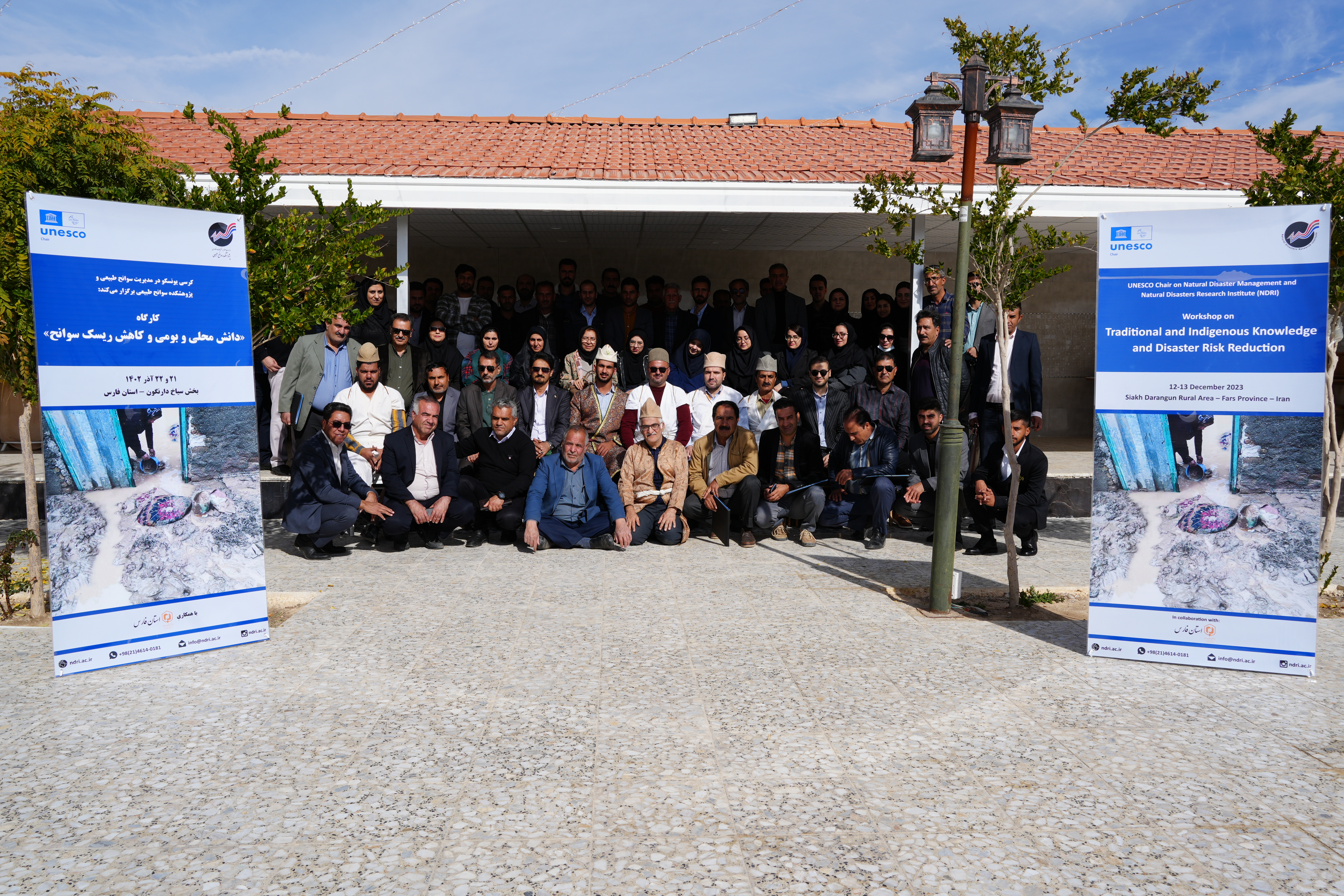
The research projects include studying the environmental impacts of hazards and disasters, exploring the concepts of Sustainable Development Goals with a focus on natural hazards, particularly elaborating on the culture of sustainable development in civil and industrial activities with a focus on prevention of environmental hazards. It also pays attention to environmental impact assessment of development as a tool to prevent or at least mitigate the indirect effects of disasters on environment.
Considering the recurrence of natural hazards and the environmental issues before and after disasters, it is inevitable to identify and research the impacts of various types of hazards, including flood, drought, earthquake, landslide, etc. on natural ecosystems. Accordingly, this research group aims at formulating policies and regulations for proper land-use and relocating buildings exposed to natural hazards. It proposes prevention and mitigation plans for natural hazard impacts and environmental conservation and recovery after a disaster.
The main activities include:
• Consulting and cooperating in documenting natural hazards;
• Studying natural hazards in rural and urban areas and identifying areas exposed to natural hazards;
• Formulating disaster risk management and environmental management plans for rural and urban settlements;
• Studying the seismic hazard, landslide, and flood zones in all provinces of the country;
• Studying the stabilization of previous landslides and providing solutions for residential settlements exposed to landslide;
• Studying indication of buffer zones for active faults in earthquake-affected areas and preparing active fault map;
• Studying soil liquefaction, land subsidence, slope stability, erosion and geotechnical issues of soils and providing methods to prevent and mitigate the damage;
• Studying the Seismic geotechnical micro zonation of cities; and
• Studying natural hazard risks at different levels of provinces and cities.
 |  |
| Mohammad Eskandarpour | Alireza Sedaqat Dehqi |
| Year | Research Title | No |
| 2019 | Exploring gully erosion in the villages of Chabahar County in Sistan va Baloochestan | 1 |
| 2019 | Stabilisation of a number of villages against landslide in Ilam, North Khorasan, Kermanshah, and Hamedan | 2 |
| 2019 | Geological and geotechnical studies of the new site of several villages in Lorestan, Golestan, and Qazvin | 3 |
| 2019 | Stabilisation of a number of villages against rock fall in Lorestan | 4 |
| 2019 | Landslide and landslide stabilization strategies of Hosseinabad Kalposh village and preparation of implementation plans for geotechnical studies of development | 5 |
| 2019 | Initial report of affected villages by natural hazards | 6 |
| 2019 | Feasibility study of relocation of rural settlements or rebuilding in the same area, Qareh Yasr-e Pain | 7 |
| 2019 | Securing the areas prone to risks in several villages in Golestan | 8 |
| 2019 | Stabilisation of a number of villages against subsidence in Golestan | 9 |
| 2019 | Leading the organization plan for the villages prone to flood in the river buffer zone in Khoozestan | 10 |
| 2019 | Securing the affected residential units following the 2019 flood in Sistan va Baloochestan | 11 |
| 2019 | Three-dimensional study of the effect of stratification in hills on magnification of earthquake waves | 12 |
| 2019 | Identification of villages at risk and prioritization of rural safety plans | 14 |
| 2019 | Review of natural hazard atlas records in the country | 15 |
| 2019 | Investigation of the global experiences for the rural safety against natural hazards | 16 |
| 2019 | Exploring the securing process of villages after the 2019 floods focusing on the supervision of the stabilization process of villages | 17 |
| 2019 | Locating, geology, and geotechnical studies of the new site of Kafcharin village | 18 |
| 2018 | Utilizing the capabilities of the freeway margin space with the approach of reducing risks and increasing economic performance | 19 |
| 2018 | Simulating the surface runoff in the coming decades under climate change scenarios with a water resource management approach | 20 |
| 2018 | Identifying fault rupture areas in villages | 21 |
All rights reserved for Natural Disasters Research Institute.
Design and developments by Armanic